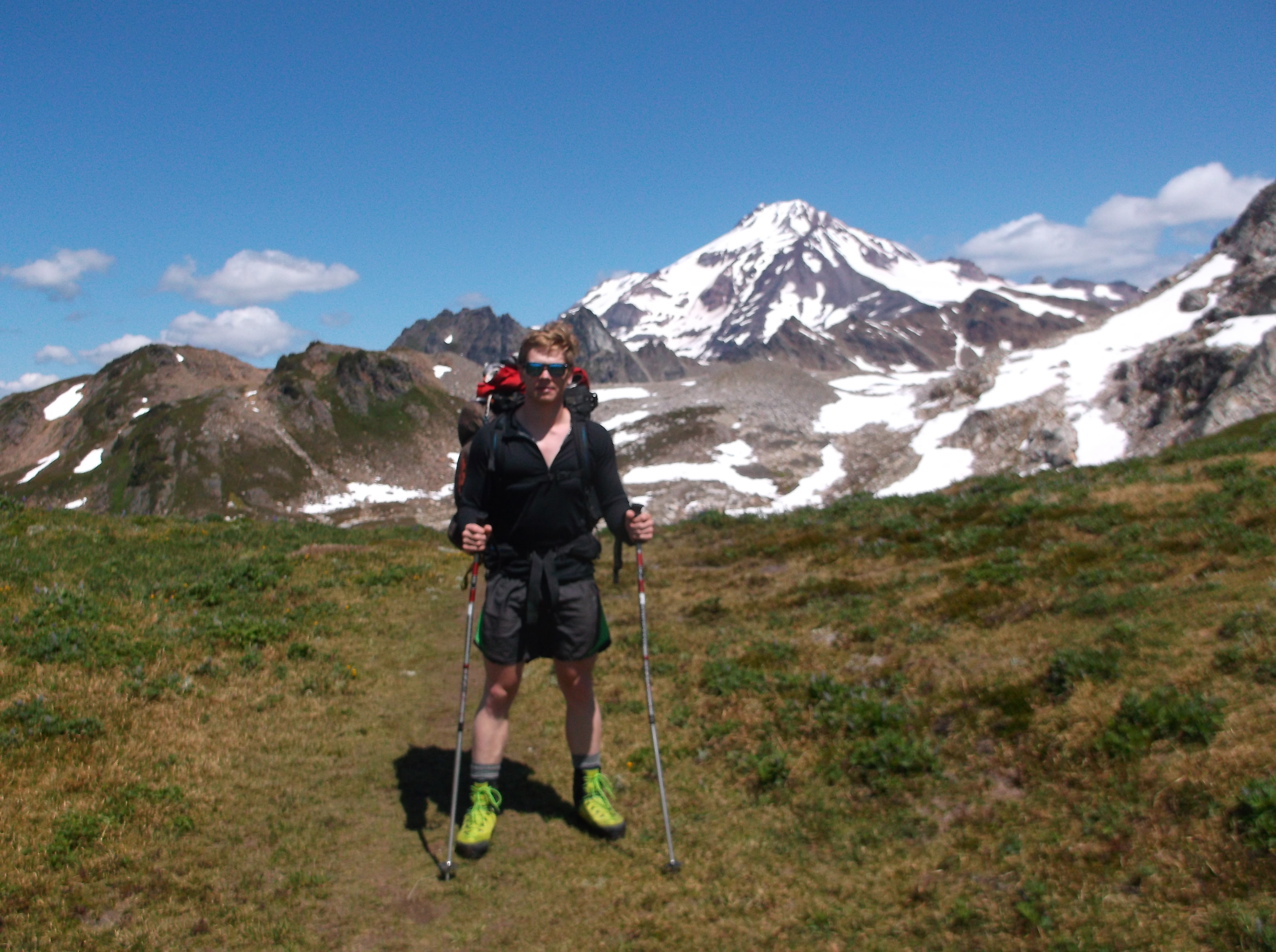
I don’t think much about pack weight, other than how heavy mine is next to Ben’s. We’re more or less the same size, same fitness, same grit, so he takes the tent and I take the stove, rope, first aid. Not much first aid. I leave the splint and tourniquet and stock up on ibuprofen and caffeine instead. Seventeen miles in, seventeen miles out, with an alpine start somewhere along the way. Quick trip. Light packs. We take the window covers down around 8 a.m. and let the sunlight get us moving. Full parking lot. One car rolling in, like we would have done if we had left Seattle before dawn instead of driving through the night. I don’t mind an early morning, but I wanted to start this one fresh.
Ben takes a caffeine pill, I hang our permit from the rearview mirror, and we grab a few leftover cookies from the driver’s seat. We wake up five miles later when the trail turns uphill.
“Is it raining or just coming off the trees?” Ben asks.
“I can’t tell. But it feels nice.”

We switchback through clouds, in and out of old landslide paths long since regrown with new life. This part is hard. Not much scenery to speak of, same as it was in the muggy river valley behind us. Just up. A tight, single-track trail like a queue. We leapfrog past two other groups, all of us going to the same place. Up, up.
Our track joins the Pacific Crest Trail for a quarter mile, maybe less. It’s a thoroughfare through the Cascades, and in this stretch, the mountainside looks like a lawn, if you tilted a lawn forty-five degrees and filled it with wildflowers. We meet two girls trekking from Baker Lake to Stevens Pass: 171 miles. A few solo hikers meander along. Four guys carry boxy saddlebags strapped to their chests, plus backpacks.
“They’re for horses,” one guy explains, which doesn’t explain anything.
“We’re the horses,” says another.
“What’s in there?” I ask.
“Popcorn! Peanuts! Hundred dollars each!”
I don’t find out what they’re carrying, or where they’re headed.
We fill our water bottles and eat at a creek just below the ridgeline. Cold water and gummy candy. We won’t eat well this trip: simple sugars, calories, salt to keep us from cramping. A freeze-dried dinner has ninety percent of your daily sodium, and we each carry two. We’ll eat those at basecamp, four valleys and five-ish miles away. Mostly flat miles, if you compare here and there and ignore all the ups and downs along the way. Until we get there, we have candy and Clif bars.
Marmots look like mountain beavers. These ones have patchy fur that almost looks mangey. They’re ugly animals, and cute. They scamper through this Edelweiss valley, and two of them play-fight on an outcrop while two others watch from the bushes, or maybe they real-fight. North America’s Lion King.
Ben’s legs cramp. Nine miles in, sick with a cold or the flu, he’s too stubborn to call off the trip or surrender much weight from his pack, which makes sense to me. They keep cramping, both legs, quads and hamstrings. The cramps trap him, stick him in place, his muscles rigid as splints. Ben swears until the cramps pass enough for him to hobble to a good, flat place where we can shed our packs and he can get some ibuprofen. I offer magnesium and potassium, too.
“How much do you have?”
“Magnesium… five. Maybe ten of potassium.”
“Let’s save them for the summit day.”
“I’ve got some salt capsules, too.”
“How many?”
“Enough.”
“I’ll take one.”
The third valley sends us through a dead glacier. Fred Beckey, legendary Cascade climber, documented this approach with a black-and-white photograph of White Chuck Glacier. Half a century later, the glacier is gone. We still find snow, but no packed layers of ice, no crevasses, no year-round jumble of landlocked icebergs.
This hike will finish up the five Washington volcanoes for me, but I still want to summit all of Oregon’s, and Idaho’s, and I want to ski Taos and Mammoth and get into backcountry touring. How many of those have a countdown? I suppose I could take up mountain biking if the snowline moves too high, but it isn’t the same. Nothing gets me going like the expanse of a glacier, white and smooth until it crevasses or seracs, and the cracks glow blue and disappear into midnight, and the seracs refract and reflect the sunrise in perfect spectrums that no paint or pixels can reproduce.
Ben and I hop over glacier errata and posthole through thin snow. It feels personal.
We pass the camp for people who summit Glacier Peak in three days, which is most people, since thirty-four miles and twenty thousand feet of elevation change feels terrible, which is partly why we’re doing it in two. The clouds are stagnating here. We walk through gray air and pick our way among patches of snow, ashy mud, and oxidized chunks of iron. Volcano country. Winter in Mordor.
The clouds shift and we spot a tarn, and another. The water looks brackish. What could live here, in the wreckage of smoke and sulfur from how many hundred years ago? The land looks tortured.
To cut weight and stay cool, I’m wearing running shoes, wool ankle socks, and short shorts. The snow soaks through. My feet are cold, and even with the clouds, I should worry about sunburn. I’m at seven thousand feet and with snow beneath me, but we’re only half a mile from camp, and I don’t want to unearth my two-pound mountaineering boots from my pack and lace up all the eyelets. I don’t want to balance on one foot to pull on long pants. A good chunk of grit comes from laziness.
We push up the last slope and step onto dry earth. Glacier Gap. Basecamp. We claim the best campsite, which has three windbreak walls where we dump our packs, a trickle of snowmelt a hundred yards away where Ben filters water, and a smaller windbreak fifty feet the other direction where I light the stove and boil water for our freeze-dried bags of sodium.
We left the treeline behind hours ago, and we don’t have a bear canister, so I pile our food, toothpaste, and toothbrushes well away from our tent and layer the edible cairn with rocks. The mice find our tent anyway. I wake up around twilight and see one clinging to the mosquito netting above us, but not interested enough to chew its way through. The mouse scampers off, maybe toward the smell of the cairn. I don’t wake Ben.
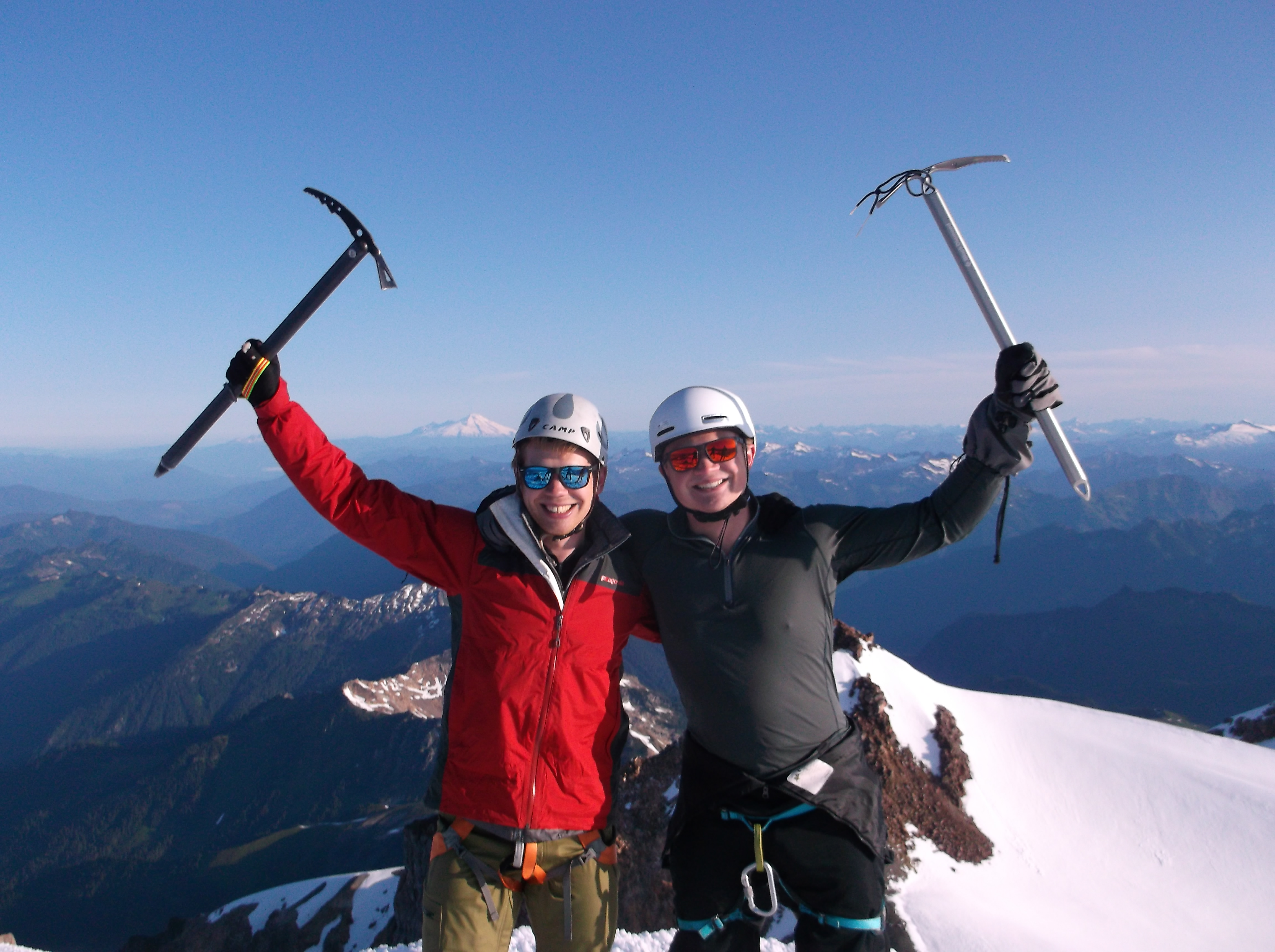
The alarm goes off at 1 a.m. We snooze until 1:30 a.m. By 2 a.m., we’re geared up in boots, snowpants, jackets, and helmets. We’ve read about random rockfall on this route, but we probably won’t find any on-route crevasses or snow bridges. We brought harnesses and rope just in case, although we left the pickets at home with the tourniquet. Quick trip. Light.
The route to the summit starts on dirt, and we keep our crampons in our packs for the first thousand vertical feet. We walk without headlamps; the moon lights the bootpath.
We’ve put off this summit for years because of the long approach. Who wants to hike thirty-four miles for a mountain no one cares about? It’s not Rainier, which everyone knows, or Shuksan, which has a fourth-class gully to excite other mountaineers. Glacier Peak is just long. Most people who chase Washington’s volcanoes leave this one for the end. Check the box. Get it over with.
Turns out the long part is the interesting part. The summit push doesn’t do much. Nothing too steep, nothing technical. We see some man-eating crevasses in the distance, but our track stays at least twenty feet away from so much as a hairline opening. Beautiful, yes. Exciting, no.
We spend ten minutes at the summit and get another group to take pictures of us. I see Baker and Shuksan to the north, Rainier to the south. I convince myself I can see Adams in the horizon. I want to stay here longer, but it feels strange to pause. We’ve hiked and eaten and hiked and cooked and hiked and hiked and have to hike it all again, and a long stop breaks the rhythm. We did all this to get here, but now I feel antsy.
It takes half the time to descend to basecamp. We don’t bother to rope up, and we run downhill in long, sliding lunges. Ben glissades a bit. We meet one couple who are doing the mountain in a single day.
“We like to sleep in our own bed,” they tell us.
Ben packs up the tent while I de-cairn our food. The mice have nibbled chunks out of two of my Clif bars, but they ignored the rest, including the half-wrapped block of pepperjack cheese, our sole nod to real nutrition this trip.
“I feel good,” Ben says over our freeze-dried lunch. “I mean, I feel sick, but I’m not exhausted yet.”
We pack up and go.
Mordor looks friendly today without its clouds. We tick off the remaining uphill sections in the ashy wasteland, the dead glacier, the marmots’ fight club. The Pacific Crest Trail is busy again. We feel good until the switchbacks, which are boring and wreck Ben’s knees and our morale.
“I’m ready to be done,” one woman told us yesterday as she descended through this stretch, and now I get it. Another switchback, six miles to go. Another switchback, still six miles. Still six miles. Another switchback. Six miles. Down, down, and no more ridgeline vistas.
I don’t remember these bumps. Or these rocks and the bruises they leave on my soles. I had counted the first five miles as a warmup yesterday, a three-miles-per-hour trail, flat and smooth and just a stroll with backpacks, really. Now the same fives miles, at a slight downhill this time, pulverize me. Every rock in the trail slams through my running shoes. Each drop, whether two feet or three inches, pummels the balls of my feet, ignites my quads, and rattles through my body.
I don’t remember this bridge, or this one, or this boardwalk, and Ben and I know we found a wrong trail. We check the map. The one trail parallels the one river, but we don’t remember. Nothing looks right.
Is this a delusion? Five hours of sleep, three hours at basecamp, twenty-two hours of hiking. Cognitive functions deteriorate with exhaustion; I once hallucinated midnight bicyclists and figures running through the woods after summiting Mt. Rainier.
Where am I? Another bridge. I don’t remember.
“I know this,” Ben says. “I know this spot.”
A stream cuts through the trail. I recognize it, too.
“We got here twenty minutes after we left the car,” Ben says.
We note the time on his watch and step down to the water: one-foot drop, two-foot drop, six-inch drop. Each one abuses my feet. We balance on rocks to cross the stream and scramble up the other bank. It takes thirty-five minutes to limp our way to the car. It takes a day and a half to get our cognition back, and a week for the soles of my feet to recover.
BIO: NPR called Josh deLacy “a modern-day Jack Kerouac” after he wrote about his 7,000-mile, no-money hitchhiking journey through the United States. Since hitchhiking, he’s found homes in the Pacific Northwest, the Episcopal Church, and the post calvin. He builds websites and designs books as the director of Branded Look LLC.
Keep Reading! Submit! Inspire Others…
If you enjoy these travel stories, please donate $5… We’re committed to remaining advert-free and so your support makes all the difference. Thanks again.
$5.00